Logo Click For Main Index
Bangor-on-Dee Aerial View of Flood.
Bangor-on-Dee Aerial View of Flood
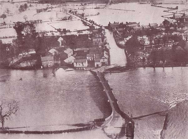
This 1945 aerial view of the village clearly shows a cluster of long since demolished houses at the rear of the Royal Oak Inn.  The recent aerial photo in the Aerial Photographs section of this web site clearly shows how the village has grown over the years.  Recent flood prevention works should ensure that such extensive flooding throughout the village is very unlikely to reoccur.
Please note:  All images on this web site are copyright, please see copyright link for more information.
Go The Parish Church
Go The Bridge
Go Events & News
Go Hospitality
Go Bangor Monastery
Go Bangor Parish 1699
Go Aerial Photographs
Go Historic Snippet's
Go Local Links
Go Local Services
Go Johnson's Baskets
Go Medieval Tomb Stones
Go Presbyterian Church
active section Old Photographs
Go School Log Book
Go Ysgol Sant Dunawd
Go War Memorial
Go William Remembers
Go Village Policeman
Go Village Views
Go Village Map
Go Who's Who 1868-83
Go About This Site
Go Contact Information
Go Copyright Information
Go More Planefacts Sites
Logo Click For Main Index